FREE SHIPPING Over $30 -> Up to 50% Off!
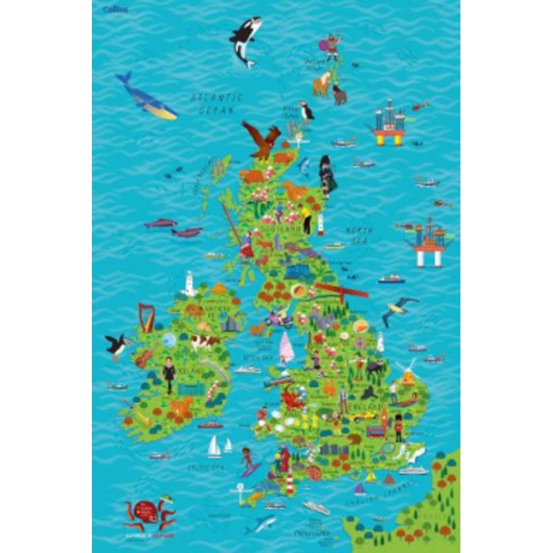
Colourful Illustrated Map of the United Kingdom and IrelandSteve has many years professional experience of collaborative practice with the major educational publishers, editors, in-house designers and authors.His creative practice includes illustration, lo
Colourful Illustrated Map of the United Kingdom and Ireland
Steve has many years professional experience of collaborative practice with the major educational publishers, editors, in-house designers and authors.
His creative practice includes illustration, logo design, cover design and full series design including online resource.
His primary passion is for children’s illustration and this is demonstrated in his creation of the new Collins Picture Atlas alongside the accompanying World Map and, more recently, the map of the United Kingdom & Ireland.
 sale
sale
 sale
sale
 sale
sale
 sale
sale
Copyright © 2025 .All Rights Reserved.Powered by www.epictalesstore.com
Reviews
There are no reviews yet.